10 reasons why the A27 Arundel Bypass should not go through Binsted
Binsted and the Downs
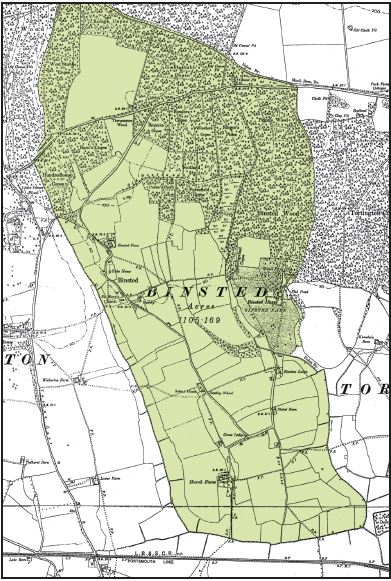
Binsted is a small rural parish south-west of Arundel, on the gentle slopes at the foot of the Downs – ‘on the southernmost flanks and outliers of the chalk’ (Countryside Agency, ‘Landscape Assessment of West Sussex’). After many centuries of independence, it was joined to Tortington in 1933, but has been part of Walberton parish since the 1980s. Its land is undulating, and slopes towards the sea, with the woods on the higher ground. From a distance, from the south or west, it can appear higher than the Downs. About half the old Binsted parish is within the South Downs National Park; misunderstanding of the area sometimes implies that the rest of Binsted is unimportant. This could not be more wrong, for the reasons below. (Fig. 1: Binsted’s ancient parish, from the 1875 Ordance Survey map)
Binsted’s remoteness and unity
Binsted feels isolated and enclosed, cut off from modern life by its stream valley, its other boundary streams and its massive woods. The lane is a no through road so there are few cars. It is not really ‘remote’ from centres of population, but this makes the perception of remoteness all the more valuable. (Fig. 2: the 12th-century church seen from the Rife valley)

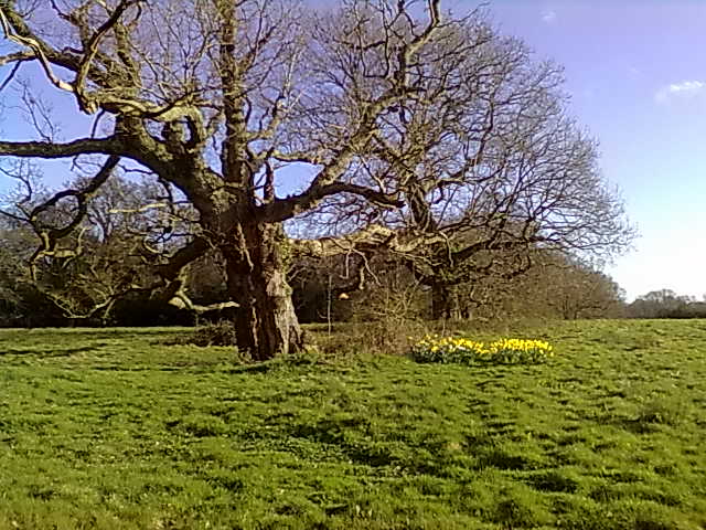
Binsted’s 32 spread-out houses form a semi-circle linked to, and overlapping with, the curve of the woods. There are historical reasons for this layout – see the next section. Copses in the main stream valleys reach from the woods into the fields. As you move round the parish, the linking shaws and copses first hide then reveal the huge main block of woodland, with the ever-changing shapes of the woodland edges providing many different views. It is ideal for peaceful recreation, as many walkers, riders and bikers know. (Fig. 3: Ancient oaks in Broad Green field within Binsted Woods)
Binsted’s mediaeval parish
Binsted is historically a peninsula or spit of land. It was cut off from the coastal plain by marsh on three sides; this was the reason why Binsted lane wanders in a U-shape. Within this ‘island’, Binsted’s self-sufficient mediaeval parish, separate until 1933, raised its own taxes and had a poorhouse next to the church. The central fields were farmed communally, and not enclosed until 1606 or 1615, with some ‘strips’ surviving in 1840 (Victoria County History). Binsted has survived with the imprint of its ancient land use on its lane and spread-out houses. Many farming parishes moved their houses into a village centre from the 18th century onwards; Binsted did not. This history, once perceived, adds a feeling of ancientness to the sense of unity and isolation.
Binsted’s Rife valley
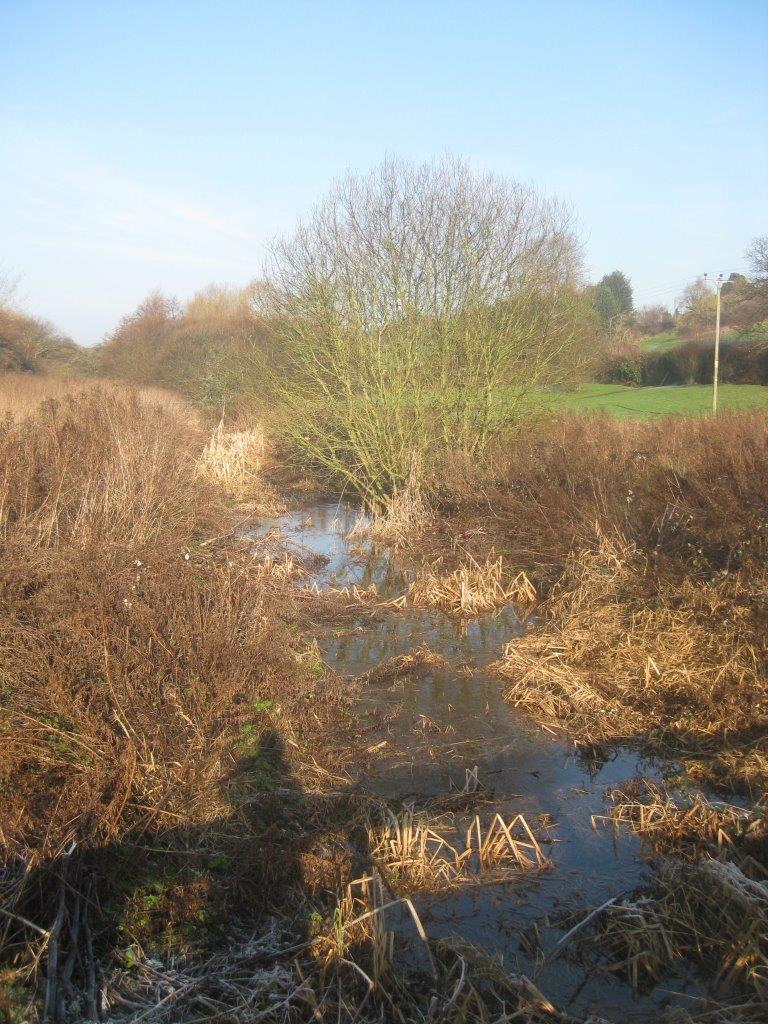
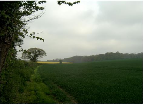
The old parish’s western boundary is the steep-sided Binsted Rife valley, thought to be a glacial meltwash valley formed by water running off the Downs at the end of the last Ice Age (information from John Mills, County Archaeologist). Though only 60 ft deep at Avisford (where the A27 crosses it), the valley is a dramatic feature, almost completely hidden until you are within it. The northernmost part (in Binsted) is wooded, the central area forms part of the Hilton Hotel’s golf course (with a useful, well-maintained bridge across the Rife), and the southern part is a haven for wetland wildlife with no public access. (Fig. 4: part of Binsted’s Rife valley)
Binsted and the South Downs National Park
All of Binsted’s woods, 8 of its houses, and 12 of its fields are within the National Park. Reports for the Countryside Agency before the creation of the Park said that the whole area from Walberton to the river Arun (i.e. the whole of Binsted, as well as the western bank of the Rife to the B2132) met the criteria for National Parks. The draft boundary included only the main block of the woods, without the outlying copses. Many organisations argued for more to be included, and a small addition was made, so that the final boundary includes the whole of the Binsted Woods Complex SNCI and its most closely related fields. (Click for Fig. 5: part of the SDNP boundary, both draft and final)
Binsted’s historic woodland
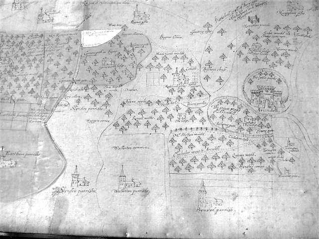
Binsted woods (250 acres) and neighbouring Tortington Common (180 acres) are part of a historic large woodland reaching to the top of the Downs. The 1600 map of Arundel Forest, ‘created in name after the Conquest, but probably older’, shows Binsted, both woods and fields, with its 12th-century church, as part of the Forest (information from Heather Warne, author of the Victoria County History article on Binsted).
Binsted may have played an important part in administering the Forest. Binsted Hundred, a Saxon unit of administration, was later called Avisford Hundred, possibly named after ‘Aves’, a court which dealt with forest regulation. (‘Hundredhouse copse’, the name of a woodland within Binsted Woods, may record where the Hundred met.) Such courts were held on the edges of a forest once a year to remove pastured animals from the forest for the closed season. Much of the woodland of this ancient forest still remains, extending to the top of the Downs, though cut through by the modern A27. (Fig. 6: part of the ‘Arundel Forest’ map)
Binsted Woods and Tortington Common
The 250-acre woodland at Binsted is so species-rich that it was described as ‘nationally important’ by the environmental consultants who evaluated bypass routes through Binsted Woods in 1992. Their evaluation was of Binsted Woods only, and a strip of woodland along the south edge of Tortington Common. At that time the rest of Tortington Common was thought to be of less interest ecologically because much of it was conifer plantation. Since that time Tortington Common has changed, with some replanted conifer areas having been allowed to regrow after the 1987 hurricane as ‘ancient semi-natural’ woodland. Its restoration continues.
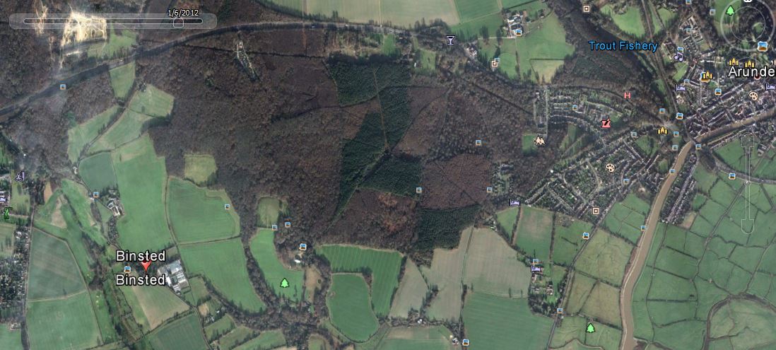
Both areas are ancient woodland and are nationally protected. Binsted Woods are ‘ancient semi-natural’ woodland; Tortington common is a mixture of ‘ancient replanted’ and ‘ancient semi-natural’. Only about half of Tortington Common is now conifer plantation. In 2003 Tortington Common was added to the Binsted Woods Complex SNCI, and both areas are included in the South Downs National Park (2009). Together the two very different woodland areas allow many splendidly varied round walks. (Fig. 7: Google Earth photo from January 2012, showing the true extent of Tortington Common’s conifer areas)
Binsted’s wildlife habitats
Connected to its ancient woodland is an integrally linked network of other special habitats including grazing marshes ponds and streams in the Rife Valley, ancient hedgerows and field trees, and a patchwork of fields from orchid-rich pasture to traditional arable where rare arable wildflowers are sometimes seen.
A 2003 survey by Walberton Action Group found that Binsted has 112 hedges with a total length of 25,427 metres. 95 of these connect with others, and 35 are ‘species-rich’, some markedly so, such as Copythorn West Hedge, part of the boundary of the National Park. (Fig. 8: Copythorn West Hedge: Nat Park on the right hand side, though the left is just as good.)
The successor conservation body focussing on studying, understanding and enhancing the area of Binsted (and eastwards from Binsted across to the Arun floodplain) is MAVES - Mid Arun Valley Ecological Survey.
Binsted’s archaeology
A prehistoric earthwork (bank and ditch) runs from the Little Tortington Stream in the south, under the church, and up to the top of the Downs. It was part of the ‘Chichester Entrenchments’, a system of earthworks linking to rivers and streams to define an area.
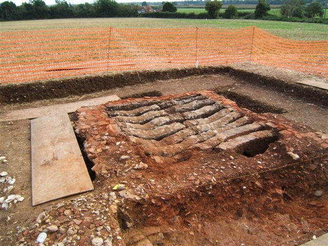
Two mediaeval tile kilns have been excavated in Binsted – one in the 1960s and another in 2005-6. ‘Binsted ware’ pottery included jugs with faces on the handles. The area near the Black Horse Pub, where Hedgers Hill joins Binsted Lane, was known as ‘All the World’ – being between the two tile kilns it must have been very busy.
Ivan Margary’s conjectured Roman road from the 1940s – on the route of the track known as Scotland Lane – also passes through ‘All the World’, and a Roman Villa has recently been excavated over several years on the opposite bank of the Binsted rife.
The field opposite the Black Horse pub is full of history – it contains part of the earthwork and one of the buried tile kilns, and is bordered by the supposed Roman road. (Fig. 9: A 14th-century tile kiln in Binsted, excavated in 2005, with the pub in the background)
Binsted’s connectedness
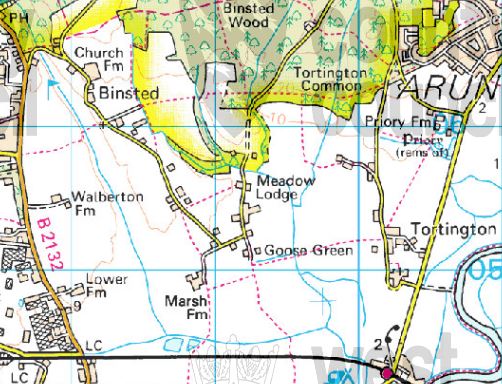
There are 11 footpaths passing through Binsted of which two are bridleways. They link Binsted, the woods and the National Park to Walberton, Arundel, Yapton, Barnham, and areas further away such as Bognor and the coast. This access from the south and west to Binsted and the National Park is via routes which do not cross any major roads. Three footpaths cross the A27 in the north part of Binsted providing links with the higher areas on the Downs.
(Fig. 10: Some of Binsted’s many footpaths, dotted red lines connecting into the National Park)
Binsted’s community
Binsted has an active village community who run up to three events a year, one of them the Strawberry Fair, the main source of income for repairing the fabric of the 12th century church. Since its inception in the 1980s, with up to 1000 visitors each year, the Fair has raised about £100,000, with a proportion of that income each year (a third to a half) going to chosen charities as well as towards the upkeep of the church. See www.BinstedFair.org .
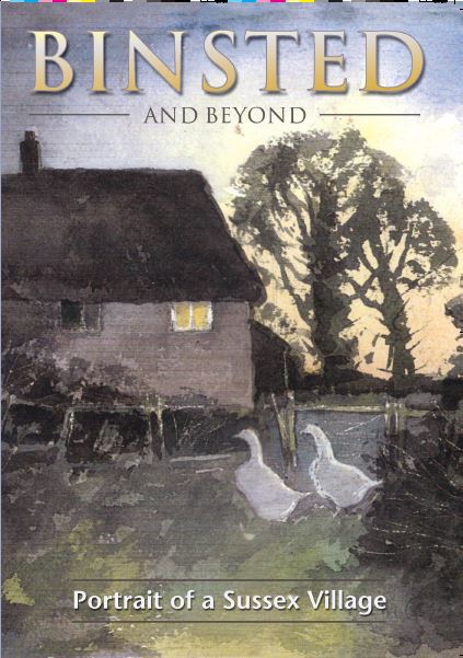
Its successful village book, ‘Binsted and Beyond’, was published in 2002 with a Heritage Lottery Fund grant and continues in print. (Fig. 11: ‘Binsted and Beyond’)