
Because of Highways England’s misleading maps and omissions, the AW (Ancient Woodland) designation may cause the destruction of part of Binsted Woods, part of the National Park, and Binsted village by Option 5A. If this happens it will be a famous, scandalous case of a planning regulation – ‘Protect AW’ – causing the maximum possible destruction, the very opposite of the intention of such legislation.
What’s really there: Binsted Woods and Tortington Common divided into separate woods. The four blocks to the east numbered 12, 19, 20 and 21 are Tortington Common. The rest are Binsted Woods.

What are Binsted Woods?
Binsted woods, 250 acres, semi-natural woodland, mostly oak and ash, are special. They are historically united – all within the old Binsted Parish, now Walberton Parish, and all part of land owned by the Wishart family since the 1920s. They contain 20 separate woods, each with its own name and history, but they share a grand, mysterious character.
They are very different from the mainly regenerating conifer plantation of Tortington Common. The difference is palpable as soon as you cross the parish/ownership boundary. You are (on Tortington Common) in woodland recovering from coniferization. Binsted Woods feel wild, and contain many huge dead trees left lying, of grotesque and impressive shapes. Some have regrown from horizontal.
Some parts are not ‘Ancient Woodland’ – but are as species rich as the rest
Some of Highways England’s maps simply leave out areas not defined as ‘Ancient Woodland’, a limited definition meaning continuously wooded since 1600. This gives the impression of a few tatty copses, instead of the reality – 250 acres of magnificent woodland. Visually, they have abolished the unity and massiveness of Binsted Woods.

Figure 7: The revised Ancient Woodland Inventory for West Sussex, Binsted Woods and Tortington Common section. Green indicates woodland classified by the AWI as Ancient. Highways have based several maps on this and just left out the ‘non-Ancient’ parts.
Binsted Woods are not all ‘Ancient Woodland’ (AW). Plots 8, most of 12, 14, most of 15, 24, and 25, out of 22 woods, are shown as not ‘Ancient’ on the Revised Ancient Woodland Inventory. But the areas that aren’t ‘Ancient Woodland’ are just as species rich as the areas that are – if not more so.
The possibility that non-Ancient woodland can be as ‘good’ ecologically as Ancient Woodland is becoming clear from new research. It poses a problem for planners, who want to think that if they preserve AW, everything is OK. But it isn’t. More research, into how quickly non-AW can take on the characteristics of AW, is necessary. But a revision of AW legislation to protect connected and nearby non-AW that is of high ecological value, such as areas of Binsted Woods, is also desperately needed.
The actual shape of Binsted Woods’ outline does matter. The total shape of Binsted Woods is rather like a crab, a large central section with two outlying ‘arms’, curving round. In those ‘arms’ is the village of Binsted, partly in the woods. If parts of Binsted Woods are blanked out, this curving protective shape disappears. The character of Binsted Woods and their relation to the landscape are totally lost. Also, the actual shape of Binsted Woods shows historical facts – assarts. These are two fields, square in shape, nearly surrounded by woodland, which were carved out of the woodland when it was part of the mediaeval Arundel Forest.
Real effect on the woods and the village of Binsted
A bypass through arms of the ‘crab’ shaped woodland from one side to the other, like 5A, would cut off its claws, mangling the sensitive area where they enclose the village.
Effect on the village: Three 3 houses in Binsted Park are within the woodland at one end, 3 are within the woodland where Binsted Lane joins the A27, and 3 are next to Hundred House Copse/Little Dane’s Wood – all these houses are within the National Park. Binsted village (38 houses) as a lovely place, much visited for recreation, would be destroyed. Many people love and visit Binsted now and enjoy walking into the woods from the Binsted side from many different approaches, across beautiful countryside; few would want to walk into what was left of them over or under a dual carriageway.
Effect on the woods: The woods now face Binsted and are part of it. They would become a sad remnant, noisy and marooned between two dual carriageways, tacked onto Tortington Common for walkers from Arundel, less attractive the closer you got to the Bypass.
Previous comparison of the 2 routes in the 1990s spoke the truth about Binsted Woods
The 1992 study which compared the ‘Green routes’ through Binsted with the Pink-Blue route – almost identical to the two offline routes being compared now - stated that Binsted Woods were ‘nationally important’ and that ‘destruction or fragmentation would substantially damage their national importance’. This is still true.
They also stated the truth about the non-AW parts of Binsted Woods: ‘It should be noted that whilst a number of woodland compartments are at most 200 years old, and therefore cannot be regarded as Ancient Semi-Natural Woodland, the flora in these compartments are locally rich and include a number of uncommon species’.
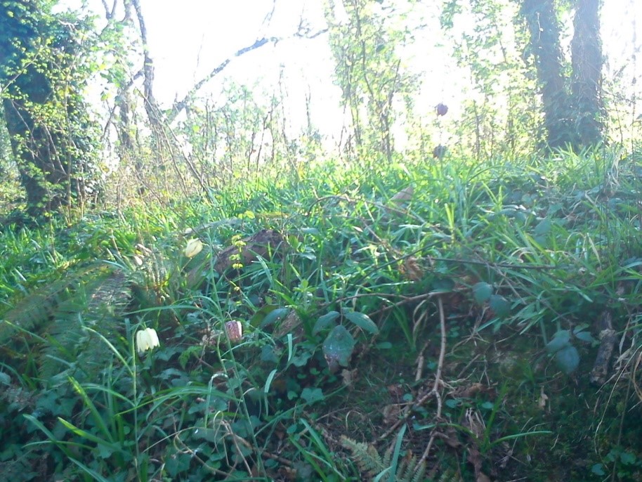
An example is these Fritillaries in The Shaw, a small stream-valley woodland connecting Binsted Woods' main block with Lake Copse ancient woodland, which happens to have been mapped when once pasture, and which would be destroyed by Option 5A.
In the 1992 study, the comparison of (in effect) 5A and 3 led to the choice of the route across Tortington Common. That has regenerated, but Binsted Woods are still ‘nationally important’. Highways England seem to be doing their best to cover this up and destroy them.

AW legislation could be the death of Binsted Woods
The tattered, negligible-looking shapes of Binsted Woods without its ‘non-AW’ areas, as shown on several of Highways England’s maps, next to the solid block of Tortington Common, are highly misleading. They would make many people looking at them without knowing the area think a Bypass through them would be acceptable, even if they were trying to consider the effect on the woodland.
Because of Highways England’s misleading maps and omissions, the AW (Ancient Woodland) designation may cause the destruction of part of Binsted Woods, part of the National Park, and Binsted village by Option 5A. If this happens it will be a famous, scandalous case of a planning regulation – ‘Protect AW’ – causing the maximum possible destruction, the very opposite of the intention of such legislation.
2018 postscript: QED.