
About the Route
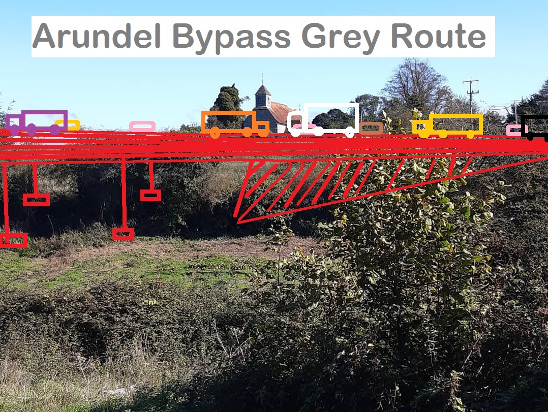
On 15th October 2020 National Highways (then calling themselves Highways England) announced their Preferred Route for the A27 Arundel Bypass: the aptly named Grey Route. This reckless 8km new road project would devastate Arundel, its surrounding villages and beautiful countryside, and impact severely on the tranquility, views and wildlife of the South Downs National Park.
Only 7% of the public, who responded to the 2019 Options consultation, wanted the highly damaging and most expensive Grey Route. Highways England's choice is not wanted by the public.
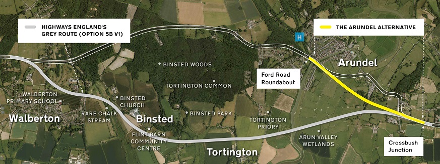
Two thirds of respondents told Highways England that they would prefer an online option with a short bypass or nothing at all, and most of those also said what they really wanted was Arundel Alternative which we support. This is a more sustainable and far less damaging short bypass with a wide single carriageway, costing two thirds less than Grey.
National Highways present their damaging Grey Route proposal on this link: https://highwaysengland.co.uk/our-work/south-east/a27-arundel-bypass/
 This plan takes a sledgehammer to smash an essential part of England's natural resource, beauty, heritage and rural community. It will lead to local species extinctions as it severs connected habitats of ancient woodland and wetlands housing 14 bat species, the UK's biggest surveyed dormouse population, and many more. It will only make the climate emergency worse. The map below shows the wider impact of the scheme - the Draft Order Limit, land which can be impacted in many different ways through and after construction.
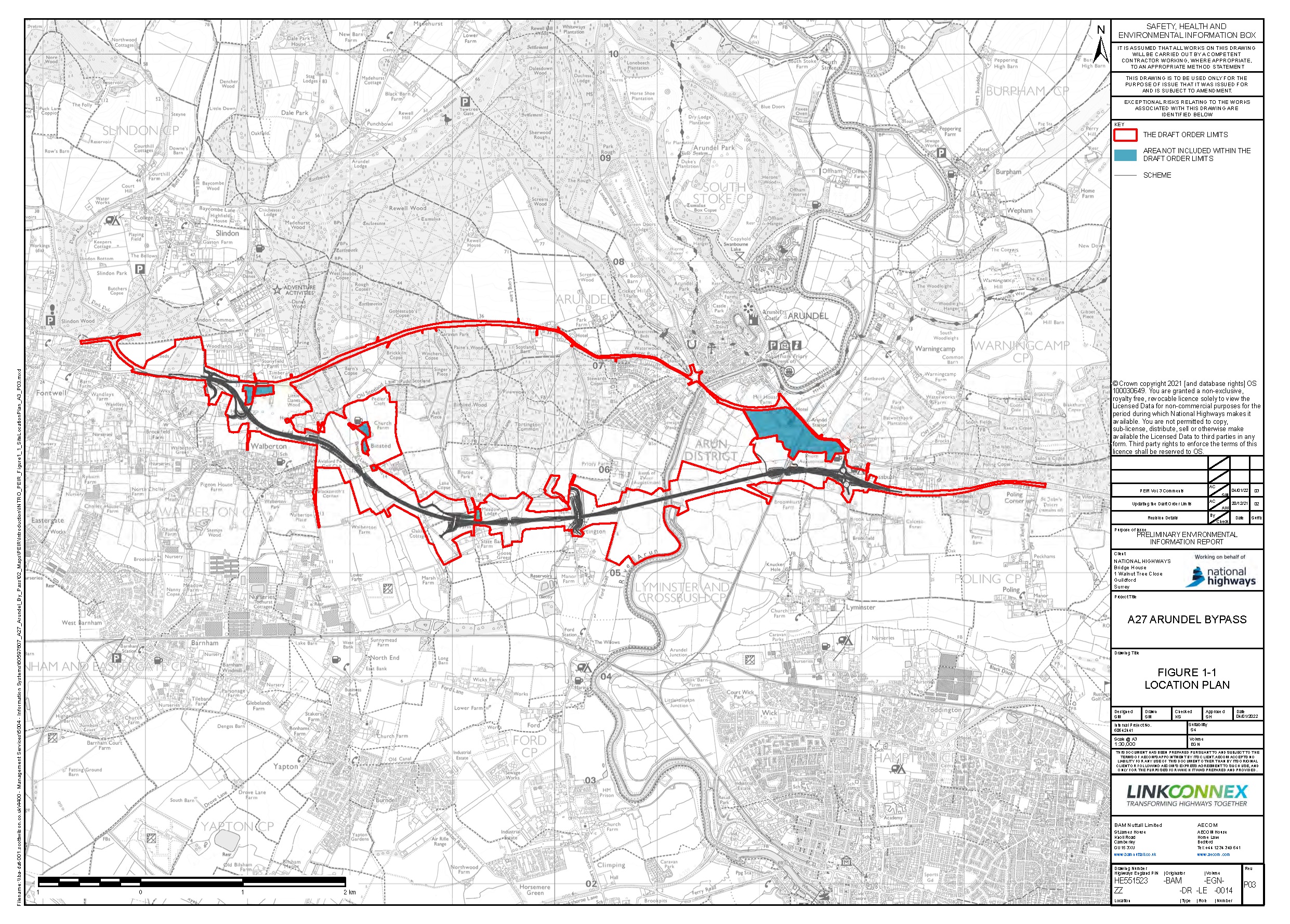
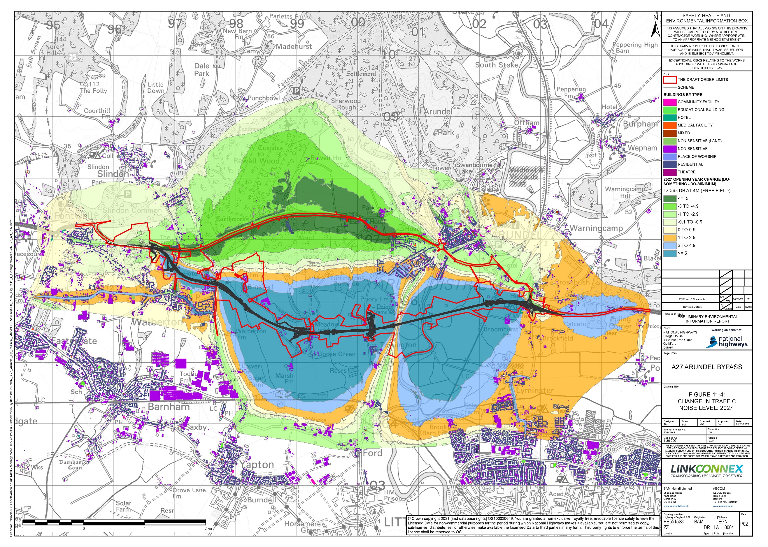
Here is the noise map of the route, showing severe noise impact on Fontwell, Walberton, Binsted, Tortington:
Click on this video to watch a quick aerial photography overview of the route:
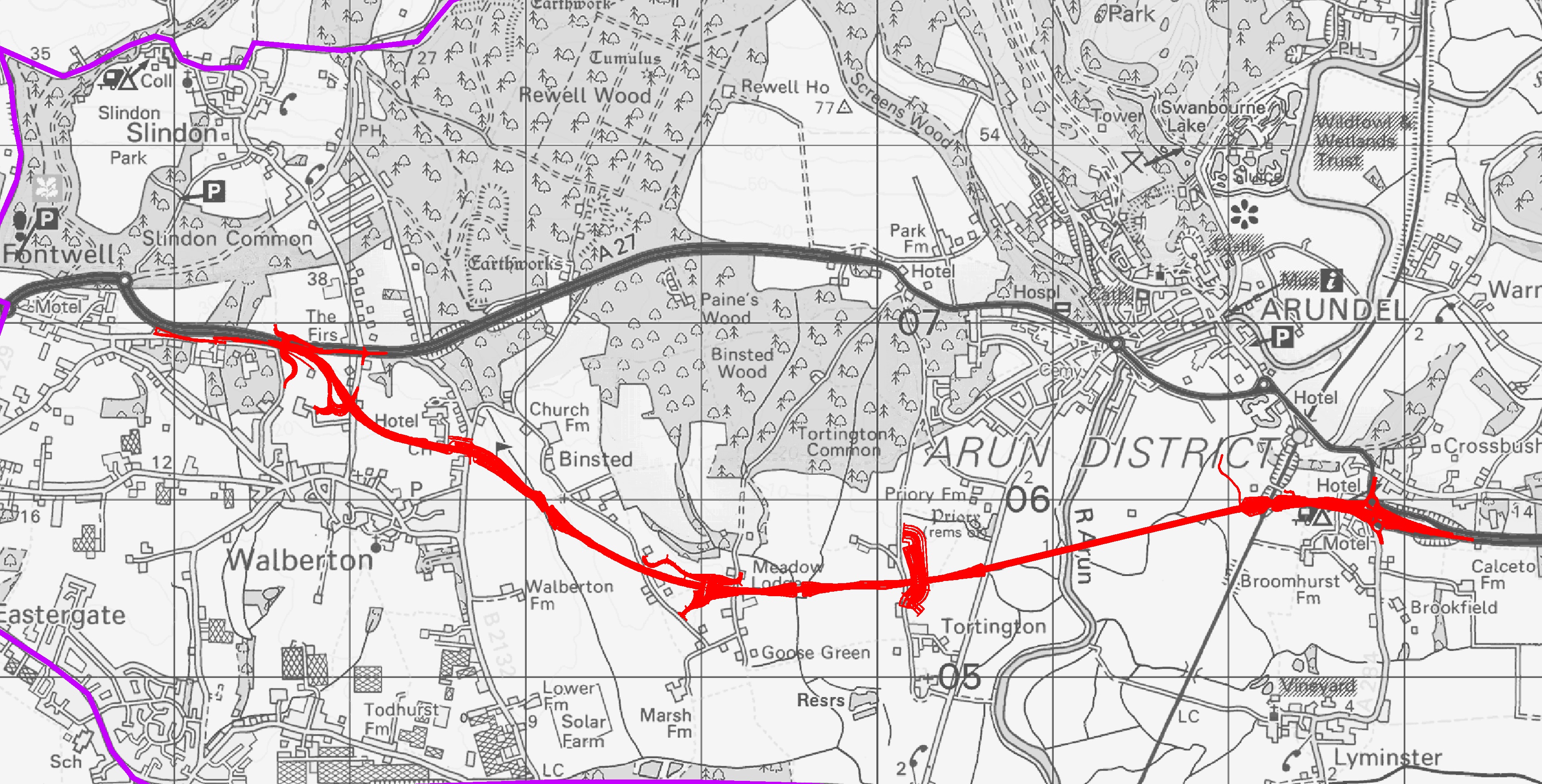
Above - overlay of Highways England mapping on to Google Earth: Credit Brian Drury.
The route has changed very little since this film was created. Below - A walk through Binsted Village - the impact of the Grey RouteThe Grey Route shows no respect for England's Heritage
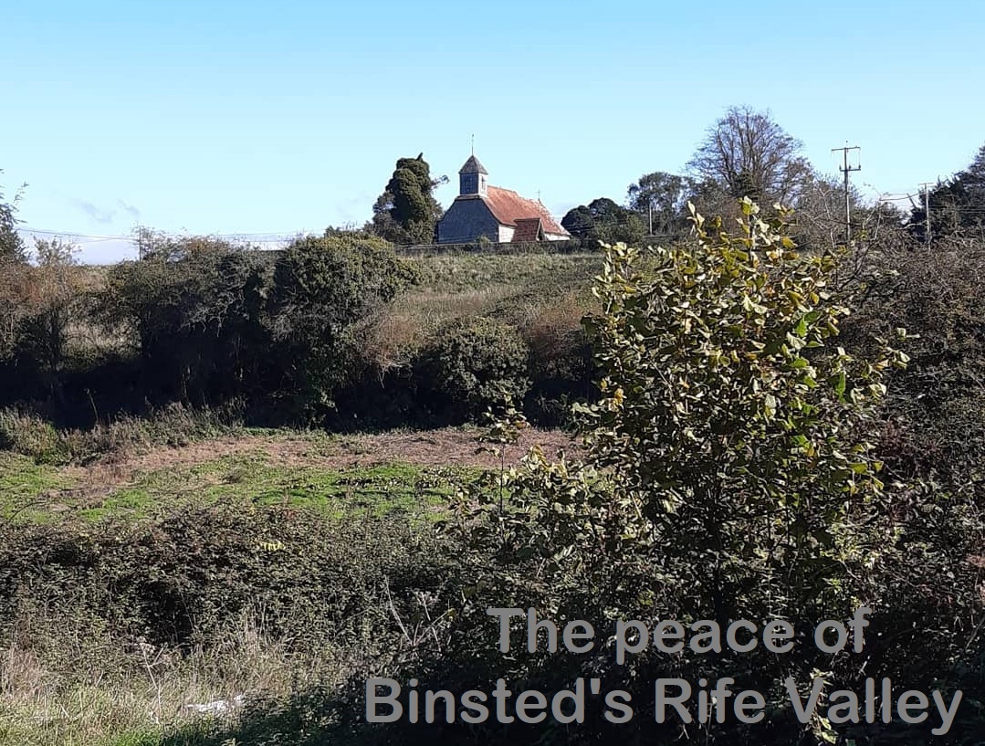
Below is a drone view of Binsted's 12th-century Grade II listed village church. This is still a hub that brings villagers and visitors together for it's peaceful beauty. The Grey Route heads straight towards it across the field and the valley, which it crosses on a raised viaduct near the churchyard, just about 70 metres away from the churchyard wall. A thousand years of community life in this rural area are under threat.

What you could lose
– The quality of the Ancient Woodland
– Villages and communities
– Arundel’s watermeadows
– Rare chalk streams
– Endangered species– Historic parkland
– Diverse wildlife
– Local business
– Carbon stores
– Beauty and tranquillityThe photos above show some of the beautiful areas that would be devastated by Highways England’s scheme. Top: the River Arun at Tortington, Bottom: approaching the Rife Valley from Walberton.
Arundel Alternative leaflet
Click here to download this 'Say No to Grey' poster for printing

There's an easy way you can now help to overturn this decision.
Please email or write a personal message to Ministers, attaching a copy of the letter we have written jointly with ArundelSCATE, and a copy of the Arundel Alternative leaflet.
If you would like support us, then send us an email with your contact details.
We will keep you in touch with Arundel A27 affairs by e-newsletter.
